Japan is a hazard vulnerable zone. Every year, Japan gets hit by numerous natural disasters such as earthquakes, cyclones, typhoons, floods, and even volcanic eruptions. Depending on the area, the destruction of natural disasters can be more severe than that of other area.
Hazard Map by Japan Government
The Ministry of Land, Infrastructure and Transport has published a map showing area that are under the risk of floods, mudslides, and tsunami. This map also shows at what level the area is at risk of the above natural disasters.
Below are maps showing areas near Tokyo that are under the risk of floods. The color red refers to higher risk compare to orange and yellow.
We can see that Edogawa Ward, Katsushika Ward and Adachi Ward are mainly covered in red and orange.
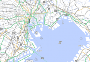
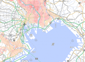
You can access the hazard map HERE.
This map is available for all area in Japan and you can search by inserting an address.
Typhoon Hagibis Taking a Toll in Kanto Region
So, how does this relate to real estate investment?
This has been mentioned many times in my past blog, but again, when buying a real estate, location is crucial.
Besides railway station and the distance from the station, the risk of being affected by natural disasters is also one factor that cannot be neglected.
Typhoon Hagibis that hit the Kanto region of Japan on October 12th, 2019, was one of the most devastating typhoons in the past years.
Heavy rain was observed in the Kanto region. Hakone marked a new national record with a total rainfall of 922.5mm in 24 hours.
The extremely intensive rainfall took a toll in Kanto Region.
The Tama River in Setagaya Ward of Tokyo overflowed and flooded at least 40 houses and leaving several under power outage and suspension of water supply.
High Rise Residential Buildings Affected
Futagotamagawa in Setagaya Ward and Musashikosugi in Kawasaki, were newly redeveloped area with high rise residential complexes that are popular among young couples and families with mid to high income.
In Typhoon Hagibis, the undergound electric switchboard in these high rise residential complexes were flooded triggering power outage and malfunction to elevators. The backflow from drainage pipies due to overflow of the Tama River cut off water supply to the buildings. Residents were trapped with no power and water supply.
Who’s at fault?
Japanese criticizes developers who involved in developing the area and the high rise buildings. Futagotamagawa and Musashikosugi are low-lying areas that are prompt to floods in case of river overflow.
In fact, when looking at old landscape maps, Futagotamagawa and Musashikosugi are full of water channels conntecting to the Tama River.
Below is a comparison of Futagotamawa between 1896 – 1909 and present.
Residential area was set miles behind the Tama River. People from the past have already realized the danger of living around the river and built their homes far away from the risk zone.
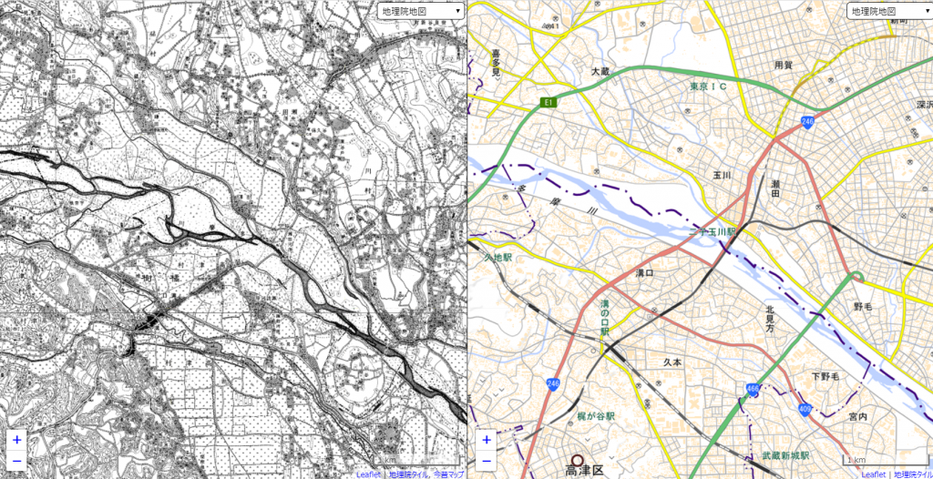
Left: 1896-1909 Right: present
You can access the above map HERE.
Price of Real Estate at Musashikosugi
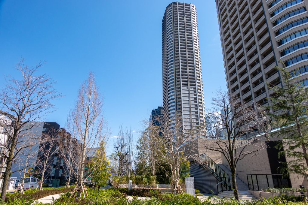
High rise residential buildings in Musashikosugi
Musashikosugi has been featuring by media as one of the most desirable cities to live in. Real estate price has also been accelerating as a result of the redevelopment and reconstruction of infrastructure.
However, after Typhoon Hagibis, it is predicted that the price will remain the same or even drop for a while.
Ownership of a high rise residential complex used to be a symbol of wealth, however, many reconsider their decision when purchasing a property after this natural disaster.


